Any weather forecast is a statistically-based guess (Statistics is a science; that does not make the subject it is applied to a science; e.g., elections, weather). Anything beyond about three days (and sometimes less): a month, three months, a year, in 2030, or in 2100 is a shot in the dark. Call it weather or climate, the math is all the same.
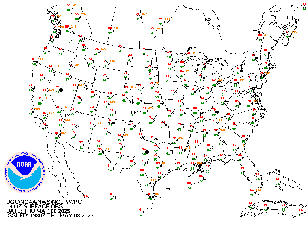
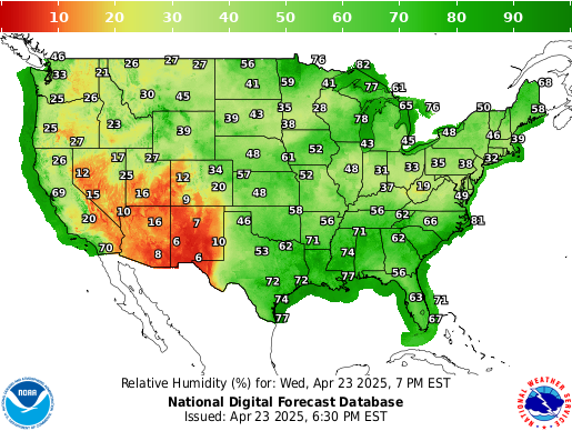
Note how badly this forecasted night-time low temperature of 41, made only hours prior, missed the actual reported temperature of 57:
Note these weather and climate forecasting issues:
(1) The parameters used in any computer modeling can be set up to predict any outcome desired (i.e., due to personal bias or that of the organization funding the forecast).
(2) Seemingly-insignificant changes to any model's parameters can result in a radically-different forecast. Computer forecast models of the weather have no validity; they are only accurate to the degree that the future is just like the past, which is never true.
The longer-term the forecast, the increasingly less accurate it will be.
Consider:
1. It is not even possible to explain, in an area where it is currently raining, why rain is occurring in one specific locale, while it is not raining in another specific locale nearby.
2. Nor is it possible, knowing the current locales of where it is raining and not raining, to predict the movement of those patches, nor the specific reasons why those patches occur or dissipate.
3. Nor is there any means of detecting where those raining and not-raining patches are, except by physically being present at the particular occasions.
4. Wind conditions are similarly unpredictable. A forecast of "gusts to 20mph" does not explain why, when, and where the gusts will specifically occur, nor the specific wind speed.
"The long-term prediction of future climate states is not possible." - p.771, Third Assessment Report, published in 2001 by the UN's Intergovernmental Panel on Climate Change (IPCC).
Prove it yourself: On any seven-day forecast, save the forecast for seven days out. Compare it to the actual weather when that day comes.
Temperatures rise during the day as the Sun's radiation warms the Earth's surface. Temperatures fall at night as the captured warmth radiates away into space. Clouds insulate, reducing the change (up or down) in temperature when present.
Typically, temperatures vary about 25 degrees between the high and low temperatures each day. If the temperature falls less at night, either cloud cover prevents heat from radiating away, or warm air is moving north from the south.
A greater drop in temperature at night or a lesser increase during the day indicates colder air moving in from the northwest: e.g., an "Alberta clipper".
Air temperature declines about 3℉ / 2℃ per thousand feet rise in altitude, which is why it is cooler in the mountains.
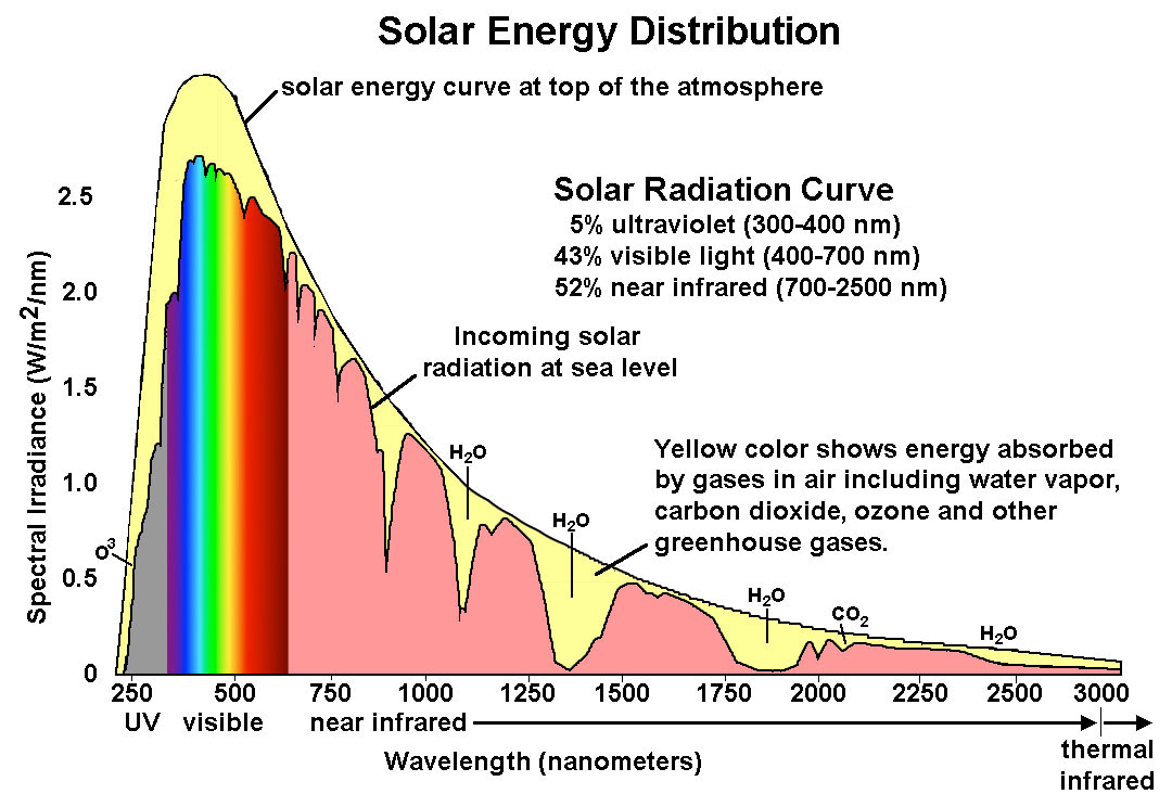
The graph at right shows the peak full spectrum of Solar radiation, which includes light and heat, at mid-day, with no clouds.
It also shows the amounts of each part of that spectrum which is absorbed by various components of the Earth's atmosphere.
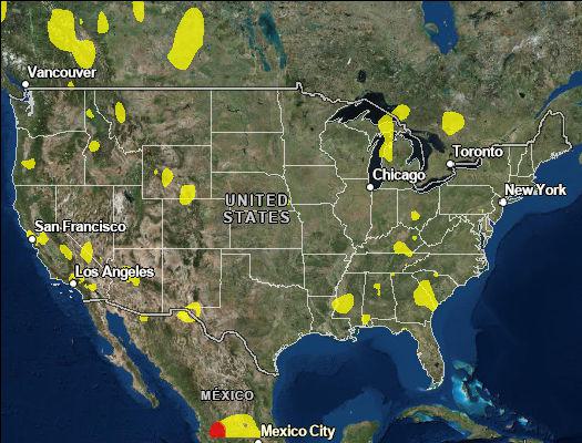
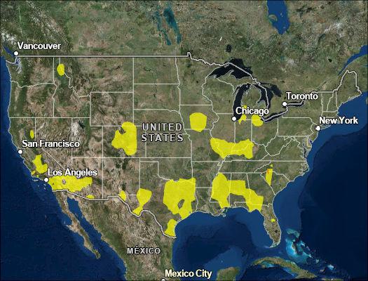
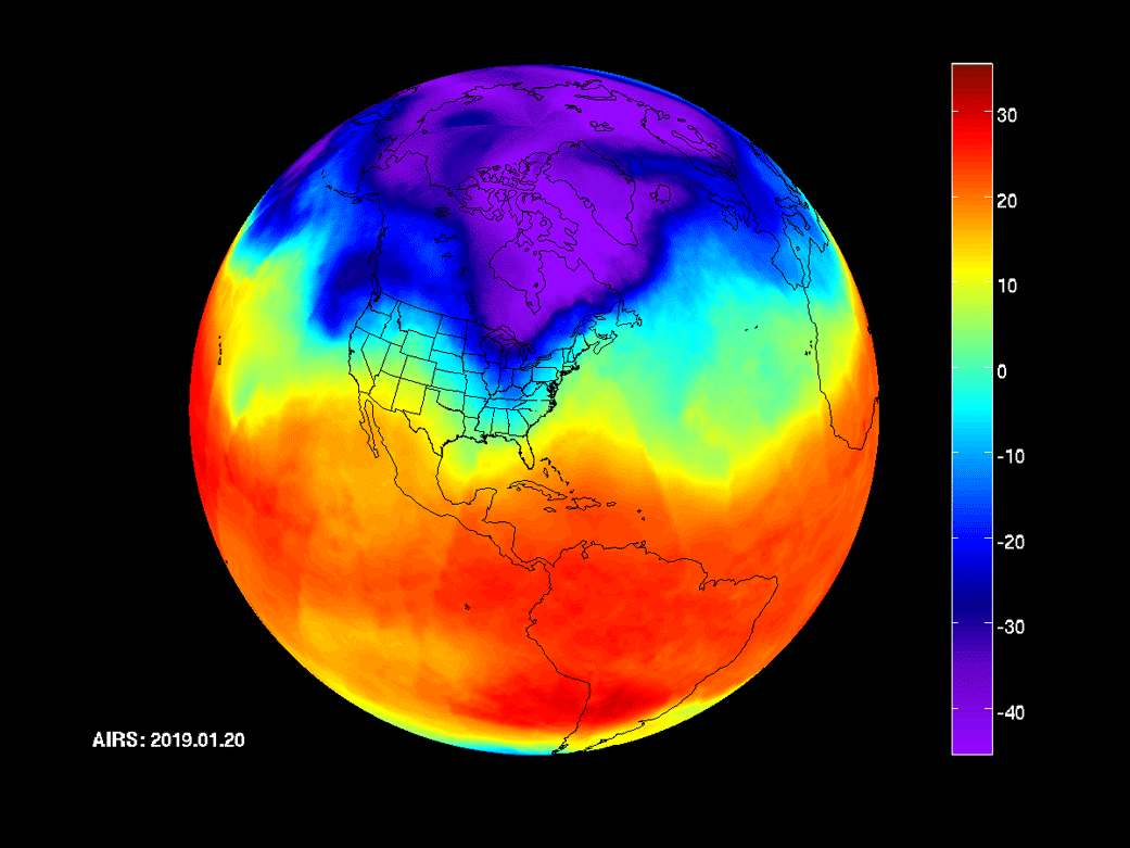
Think it is warmer now than in years past?
Compare 20 June 2024 to 20 June 1988.
In 1988, most of the U.S. was in the 90s and 100s.
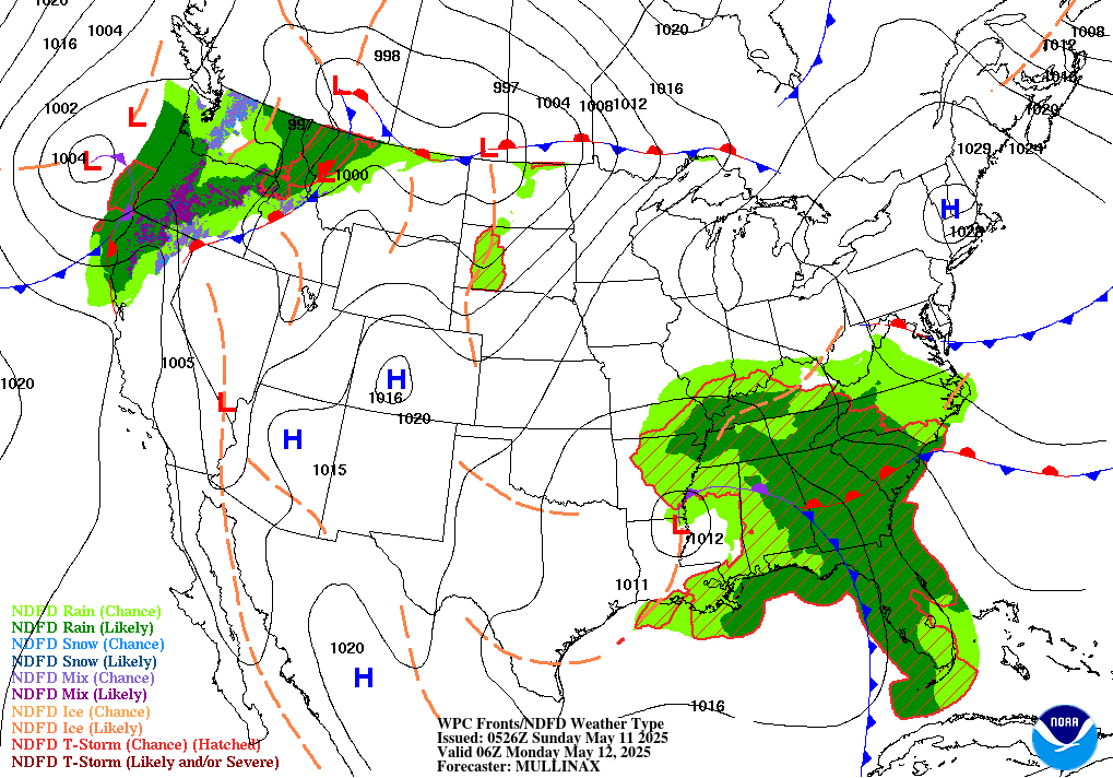
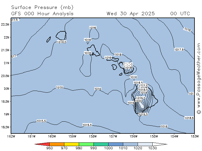
Air pressure is shown in millibars or inches. The average (standard) air pressure at sea level is 1013 millibars (mb), or 29.92 inches.
Any area with a lower value is an area of low pressure. Any area with a higher value is an area of high pressure. The further the pressure is from 1013, the greater the speed of the associated winds.
Weather charts will often label an area as a low, even if it is above 1013 but it is surrounded by higher air pressures, particularly if the winds are circulating counter-clockwise (in the northern hemisphere; clockwise in the southern hemisphere).
High pressure tends to bring sunny weather.
Low pressure tends to bring clouds and precipitation (rain, sleet, or snow, depending on the temperature).
Air pressure declines as the altitude rises above sea level, which means you get less oxygen with each breath. At 11,000 feet, the air pressure is only two-thirds (670 mb), which means you are only getting two-thirds as much oxygen in each breath as normal (your body, of course, has no mechanism to judge how much oxygen is in each breath). At 18,000 feet, the air pressure is only half (506 mb). These are standard values; the actual air pressures will vary, as they do at ground level.
Peoples' tolerance for getting less oxygen varies; some people can go no higher than 5,000 feet (843 mb); others can go as high as 14,000 feet (595 mb) with no problem. The bodies of people who live at high altitudes adapt, and those people can go higher. Vision can also be affected by high altitude, particularly at night.
The lowest pressure ever recorded (at sea level) was 867.93 millibars, in the eye of typhoon Tip over the Pacific Ocean on 12 October 1979.
The highest air pressure ever recorded was 1085.68 millibars at Tosontsengel, Mongolia, on 19 December 2001.
Fronts
A front is a meeting of two air masses, usually with differing winds, temperature, and humidity.
Low pressure areas tend to be part of a front.
High pressure areas tend to be the central part of an air mass.
Air masses, highs, and lows vary in intensities, and when the differences are minimal, they are not always clearly defined.
In the northern hemisphere, winds circulate clockwise around a high, and counter-clockwise around a low. In the southern hemisphere, circulation is the opposite.
Warm fronts tend to lie more or less east-west, and divide two fairly static air masses. Warm fronts are more common in the summer, resulting in the humid, stagnant air with afternoon thunderstorms so familiar in the South.
However, warm fronts can occur even in the colder months, as these two charts from mid-December show.
A warm front has built up along the Tennessee - South Carolina borders.
It is being held in place by a Jet Stream which is stationary just north of the front, over Kentucky and Virginia, blocking the passage of cooler northern air masses southward as well as the normal movement of cold fronts from west to east.
Under these conditions, a constant presense of low clouds, high humidity, minimal winds, and light rain can persist for a number of weeks in the South.
Cold fronts tend to run more or less north-south and move eastward, with (in the northern hemisphere) the south end trailing, and can stretch for a thousand miles or more.
Cold fronts are usually the leading edge of a cooler air mass moving east, pushing out or overtaking the existing air mass.
Being an area of low pressure, winds will generally circulate counter-clockwise around a cold front. That means that a cold front will generally be preceded by winds bringing warmer southern air northward, and followed by cooler northern air moving southward.
Cold fronts often include precipitation, due to moisture carried north from the Gulf of Mexico. As that moisture moves northward, it cools and so condenses (because cooler air can hold less water than warmer air), resulting in precipitation.
The stronger the winds, the greater the temperature swings. Warmer southern air reaches further north before cooling, and cooler northern air reaches further south before warming.
Examples are most obvious in the winter, when unusually warm temperatures extend up into Iowa, preceding rain or snow on the leading edge of the cold front, or a cold snap reaches down into the Carolinas, after the passage of a cold front.
Note the big swath of high temperatures for the mid-country shown in the chart below, taken at 5:30am in late October, vs. the more-typical pre-dawn temperatures in the eastern U.S., and the colder temperatures further west.
That pattern is a fairly reliable predictor of the next 2-3 days' weather: if it is unusually warm, expect precipitation. The higher the temperature and winds, the more intense the precipitation and the less time it will take for the cold front to pass through.
The quicker and more intense the precipitation, the colder the temperatures and the higher the winds will be when the cold front has passed.
The passage of the front will be followed by a gradual return to more seasonal temperatures, until above average temperatures and southern winds again signal the approach of another cold front.
Hurricanes
Hurricanes (cyclones) are a counter-clockwise (in the northern hemisphere) swirling of high-speed winds around a low-pressure center.
As is true for any area of low-pressure, the lower the pressure at the center, the stronger will be the storm's winds.
Hurricanes form in summer or early fall, feeding and growing on the radiated warmth of ocean water and the heat of the sun, gathering energy. Hurricanes lose energy and diminish as they travel to the cooler north and over land.
Hurricanes in the Equatorial Atlantic
Hurricanes typically form in the Atlantic Ocean off the coast of northern Africa (sometimes originating as a storm over the Sahara that flows westward off the coast), or in the Gulf of Mexico.
Those forming in the Atlantic move west and then eventually northwest. If a hurricane turns north early enough, it will stay out to sea, traveling north and then northeast up through the Atlantic Ocean without making landfall. If a hurricane goes a bit further west, it will travel up the U.S. Atlantic seaboard.
Hurricanes in the Caribbean Sea
If a hurricane travels far enough west to go into the Caribbean Sea, it will typically go ashore into Central America or Mexico's Yucatan Peninsula, or turn north and travel into the Gulf of Mexico.
On extremely rare occasions, a hurricane will cross the Panama isthmus and reform in the Pacific Ocean, where it will continue traveling west towards Southeast Asia and southern China.
Hurricanes in the Gulf of Mexico
Hurricanes in the Gulf of Mexico move west and northwest. If they are far enough west, they will make landfall along the Mexico-Texas coast.
If they turn north further east, they will make landfall on the southern U.S. coast, or possibly even travel eastward and cross the northernmost part of the Florida peninsula, and then travel up the Atlantic coast.
Once a hurricane reaches as far north as the southern U.S. shoreline and northern Florida, it will move generally northeast.
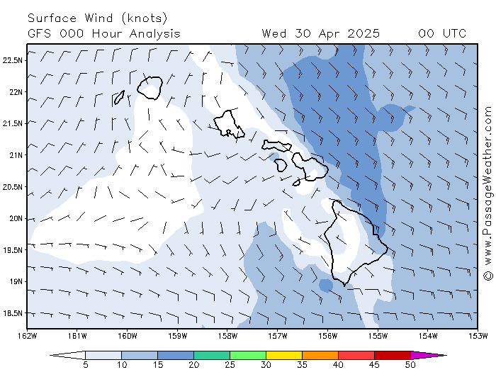
What is so magic about the U.S. shoreline along the Gulf of Mexico? That latitude is approximately the northernmost limit of the equatorial trade winds (see diagram and below), which generally flow east to west.
The actual limits vary over time, like any weather feature. North of that latitude is the northern hemisphere's temperate zone, where the prevailing winds flow west to east. A hurricane follows the existing prevailing winds of the latitude where it resides.
This chart illustrates that airflow very well.
Note that the winds west of Cuba are flowing east to west. West of the Keys and mid-Florida, the winds are flowing northward. Further north, along the Gulf coast and in southern Mississippi and Alabama and in northern Florida, the winds are flowing west-to-east.
Gulf hurricanes that come ashore west of Panama City, Florida, will usually go up the Mississippi River Valley. Hurricanes making landfall east of Panama City will typically pass over central Georgia and the Carolinas, usually diminishing into windy rainstorms.
On rare occasions, a hurricane will cross northern Florida, and move into the Atlantic. From that point, its movement follows the same pattern as any Atlantic hurricane i.e., usually up the Atlantic coast of the U.S. (see below).
Hurricanes in the U.S.
Hurricanes almost never straddle the Appalachians. The mountains disrupt and interfere with air flow, dissipating energy, so the part over flatlands remains stronger, and that focus of energy dominates, pulling the hurricane away from the mountains as it moves northward.
Those travelling up the Mississippi River Valley will generally continue on into the Ohio River Valley, crossing the Appalachian mountains in Pennsylvania.
In some cases they will go further north into northern Ohio and Quebec, usually due to the air-flow around a strong high-pressure area parked off the Virgina-Carolinas coast (e.g., the classic Bermuda High).
In either case, by that time they will have lost a lot of energy and been reduced to heavy rainstorms. However, heavy flooding is still possible.
The Exception: Hurricane Helene in 2024
Helene came up the Gulf from western Cuba. Passing through Georgia and western South Carolina, its winds and rain not only failed to weaken, but actually grew stronger. Finally, Helene turned her full force and fury on the mountains of North Carolina, resulting in deaths and severe destruction while crossing over them and heading northwest into Kentucky and the Ohio River Valley. From there the storm quickly weakened.
What happened to cause such unique behavior?
While Helene made landfall, a strong low-pressure area was over the southern Mississippi River, moving south - again, contrary to norm.
The low fed energy into Helene, causing the hurricane's perverse strength. Ultimately, Helene's path over the mountains was due to its circling of that low (counter-clockwise), before finally breaking northward as the low dissipated.
Helene proved the importance of noticing all of the conditions in the relevant region and factoring in their impacts, and of never assuming that what is typical weather behavior is necessarily a good predictor of weather.
Hurricanes on the Atlantic Seaboard
For hurricanes traveling up the Atlantic seaboard, the part over land quickly loses strength, while the part remaining over the ocean weakens less quickly, feeding on the energy radiated by the warm ocean water. It will also push lots of rain-filled airflow landward along its north side, as a result of its windy counter-clockwise circulation, causing heavy rains and flooding. The greater energy on the ocean side dominates, causing the hurricane to hug the coastline, and not go inland.
Hurricanes traveling up the Atlantic coast will typically meet up with a cold front as the front moves eastwards across the U.S., and the two will merge sometime during the passage of both through the mid-Atlantic states. That combination will often result in a "nor'easter" off the shore of the New England states, as the storm finally heads back out to sea, off Maine and Nova Scotia.
Hurricanes in the North Atlantic
Once out to sea in the northern Atlantic, the storm will head for Europe. There it will often make landfall with enough energy to be a fairly-heavy rainstorm, which may include some flooding. The storm will diminish as it moves eastward across Europe and dissipate as it continues on into western Asia.
North Atlantic Tropical Weather Summary 2016-2025
Winds
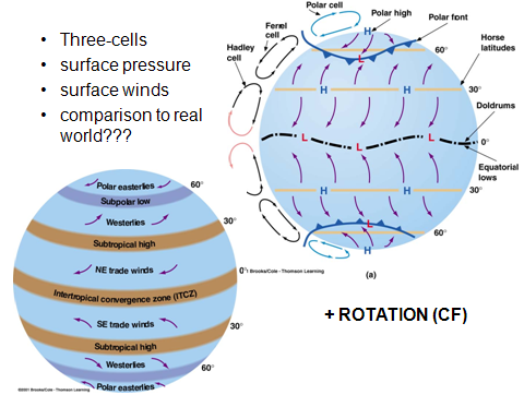
Regarding winds and the movement of air masses, the Earth can be divided into three general areas: the polar regions, the temperate zones, and the equatorial regions. See the example above, under hurricanes. For more about prevailing winds, click
here
or on the diagram at right.
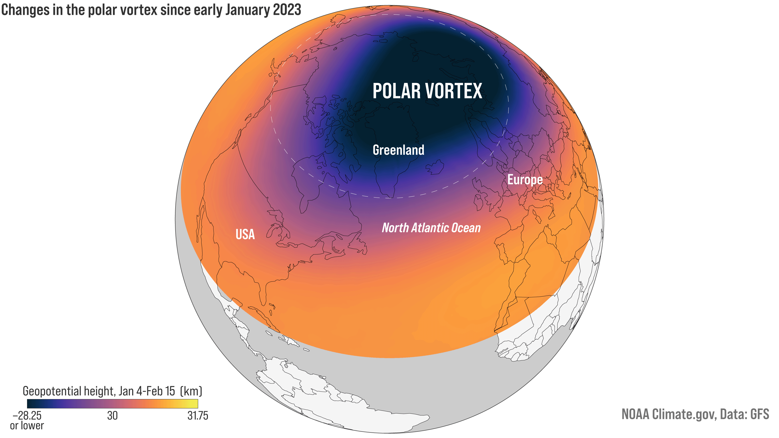
Polar Vortex
What is a polar vortex?
Basically, it is when a very cold polar air mass travels down into the temperate zone.
The animated diagram below shows airflows during a polar vortex (in purple), looking down from above North America.
The graphic below shows a polar vortex in January 2023.
A Year's Weather Unfolds: Watch 2013's Weather Across the Planet
For more information about the weather and flying conditions, see our
Aviation Weather
webpage, which includes links to METARs and TAFs for many airports.

:max_bytes(150000):strip_icc()/weather_fronts-labeled-nws-58b7402a3df78c060e1953fd.png)